
Google Maps Roof Measuring Tool: What It Can Do and Where It Falls Short

If you’ve searched for a google maps roof measuring tool, you’ve probably already noticed the problem: people use that phrase to mean several different things.
Sometimes they mean the built-in measurement feature in Google Maps or Google Earth. Sometimes they mean a third-party site that uses Google Maps imagery to trace roof outlines. And sometimes they mean a paid roofing measurement report that happens to use satellite data in the background.
That matters, because the tool you choose changes the quality of the number you get. A rough outline from map imagery can help you budget shingles or screen a lead. It is not the same thing as a contractor-grade takeoff for a complex roof with dormers, hips, valleys, and pitch changes.
I’ve spent enough time estimating roofs to know the trap: people want one clean number, but roofs don’t work that way. The best tool is the one that matches the job. If you need a quick planning figure, a map-based estimate may be enough. If you need to bid tightly or order material with less risk, you need more detail.
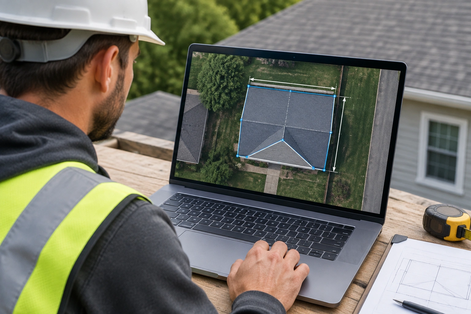
What a Google Maps Roof Measuring Tool Actually Is
There is not one single official Google product marketed as a dedicated roof measuring tool. In practice, the term usually refers to one of three things:
- A measurement feature inside Google Maps or Google Earth.
- A third-party calculator that uses Google map imagery to outline a roof.
- A roof measurement service that uses aerial imagery and software to produce a report.
That distinction matters because the capabilities are very different. A map-based tool usually gives you a 2D footprint. That means it can help estimate the roof’s projected area, but it does not automatically solve pitch, overhangs, or the added surface area created by slope.
Google Maps itself has a community-supported workflow where you drop a marker, then use the measure distance option to continue. Google Earth also has a Measure tool that can measure distance or the surface area of a selected area on the map. Those are useful functions, but they are still map measurements, not a full professional roof report.
If you want a broader comparison of tool types, see our guide to roof measuring tools and the related roof pitch calculator tool guide.
How Roof Measurements Are Estimated from Google Maps and Satellite Imagery
The basic workflow is simple:
- Find the property on the map.
- Zoom in until the roof outline is visible.
- Trace the roof perimeter or each roof plane.
- Read the area or distance result.
- Apply any needed roof pitch adjustment, waste factor, or section-by-section correction.
That last part is where many estimates go wrong. A roof is not just the flat outline you see from above. If the roof has slope, the actual surface area is larger than the projected footprint. If it has multiple levels, each section should be measured separately.
That is the right mindset. Don’t draw one giant shape across the whole house if the roof has different planes. Measure each visible section as its own piece, then add them together.
There’s another practical point: the roof edge you trace should be the outer eaves, not the wall line. If you trace the walls, you undercount the overhang. If you trace too far out, you overcount. On a simple roof, that difference may be small. On a roof with wide eaves, it can matter.
How to Translate Area Into Materials
Area is the starting point, not the final takeoff.
For shingles, you usually convert the roof area into squares and then add waste. One square equals 100 square feet of roof coverage. So if a map-based tool gives you area in square feet, you still need to convert that number into squares, then add a waste factor based on roof complexity and layout.
Underlayment is similar. You start with the roof area, then convert it into rolls or coverage units based on the product you plan to use. Ridge cap, starter strip, and other accessories are not always captured by a simple area estimate, so those often require manual conversion from roof dimensions or ridge length.
That is the key limitation of many Google Maps-based tools: they can help estimate roof area, but they do not automatically produce a full materials list. If you need shingles, underlayment, ridge cap, starter, drip edge, or venting quantities, you usually still have to convert the area and linear measurements yourself.
A practical workflow looks like this:
- Use the map tool to estimate roof area.
- Convert area into shingles or squares.
- Add waste factor.
- Measure ridge and edge lengths separately if you need ridge cap, starter, or trim.
- Manually adjust for pitch, sections, and any roof features the tool did not capture.
How Accurate These Tools Are for Different Roof Types
Accuracy depends less on the brand name and more on what you need the number for.
Homeowner budgeting
For a homeowner trying to budget a reroof, a map-based estimate is often accurate enough if the roof is simple and the imagery is clear. In practical terms, “accurate enough” means close enough to compare contractor quotes, set a budget range, or decide whether the project is in reach. It should not be treated as a final purchasing number for a large material order.
Contractor screening
For contractors screening leads, a rough estimate is often enough to decide whether a job is worth an in-person visit. Here, “accurate enough” means the estimate helps you avoid wasting time on roofs that are obviously too large, too complex, or too risky for the budget. The goal is speed and triage, not bid precision.
Bid-ready takeoffs
For bid-ready takeoffs, “accurate enough” means the measurement is detailed enough to support pricing with limited risk. That usually requires section-by-section measurement, pitch adjustment, waste allowance, and a report you can review. A basic map trace is usually not enough on its own.
Simple roofs
A simple single-story gable or hip roof with clear imagery is the best case. The outline is obvious, the planes are simple, and there are fewer places to make a tracing mistake. For a homeowner trying to budget shingles or compare contractor quotes, that kind of roof is often good enough for a rough estimate.
Complex roofs
Add dormers, valleys, multiple ridges, or different roof levels, and the error risk climbs fast. You can still use a map-based tool, but the estimate becomes less trustworthy unless you break the roof into separate sections. That is where many free tools start to feel too coarse.
Obstructed roofs
Tree cover, shadows, image blur, and outdated aerial photos make the whole process shakier. If you cannot clearly see the roof edge, the measurement is only as good as your guesswork. In those cases, a remote estimate can still help with early planning, but I would not use it as the only source for material ordering.
Key Buying Criteria to Compare Before You Choose a Tool
If you’re comparing tools, judge them on what they actually help you do, not on marketing language.
1. Does it handle roof pitch?
Pitch changes the true surface area. If the tool only gives flat footprint area, you still need to adjust for slope yourself. That is fine for a rough homeowner estimate, but it is a limitation for bidding.
2. Does it support multiple roof sections?
A tool that lets you trace separate planes is more useful than one that forces you into a single outline. Complex roofs need section-by-section measurement.
3. Does it include waste factor?
Shingle jobs need waste. Valleys, cuts, starter, hip and ridge, and pattern matching all increase material demand. A tool that gives raw area but no waste factor still leaves you to do the math.
4. Does it produce a report you can actually use?
A clean report with dimensions, area totals, and labeled sections is more useful than a number on a screen. Contractors need something they can review, save, and compare.
5. Is the imagery current and clear?
Old imagery can miss reroofs, additions, or changed rooflines. If the photo is blurry or dated, the result is less dependable.
6. How much time does it save?
A free tool may be fast, but if you spend 20 minutes correcting it, the savings disappear. Paid reports often earn their keep by reducing rework.
Google Maps-Based Tools vs Dedicated Roofing Measurement Platforms
Here’s the practical comparison most readers actually need:
| Option | Accuracy | Features | Best Use | Trade-off |
|---|---|---|---|---|
| Google Maps / Google Earth measurement | Rough to moderate | Basic distance or area tracing | Quick planning, homeowner estimates | Limited pitch and reporting depth |
| Free map-based roof calculators | Moderate on simple roofs | Area tracing, sometimes basic roof-angle adjustments | Early budget checks and lead screening | Less reliable on complex roofs; materials still need manual conversion |
| Low-cost roofing tools | Moderate to good | Cleaner reports, better section tracing, sometimes exportable takeoffs | Small contractors who need better than a free tool but not a full premium package | Still may need manual review on complex roofs |
| Paid platforms like EagleView or Roofr | Higher, report-driven | Roof sections, measurements, takeoff-style reports | Contractor bidding and material planning | Costs more than free tools |
| Drone-based measurement | High when flown and processed well | Detailed imagery and roof modeling | Complex roofs, inspections, documentation | More setup, cost, and process |
| Manual measurement | Can be accurate if done well | Direct verification on-site | Small jobs, verification, edge cases | Slower and more exposed to safety risk |
For contractors, the biggest difference is not just accuracy. It is how much confidence the report gives you when you price labor and materials. A rough map trace may be enough to qualify a lead. It is not the same thing as a bid-ready measurement package.
RoofScope says its roof measurement reports are powered by aerial imagery and CAD verification, and it also notes that estimates may not be precise for complex roofs. That is a fair reminder that even “professional” remote measurement has limits.
GAF’s QuickMeasure service is another example of a roofing measurement workflow.
Satellite-Based Measurement vs Drone-Based and Manual Measurement
Each method has a different job.
Satellite-based measurement
This is the fastest way to get a roof footprint without stepping on a roof. It is useful for early estimates, lead qualification, and homeowner planning. The downside is that you are limited by the image quality and what the camera can actually see.
Drone-based measurement
Drones can capture more detail than a static satellite image, especially on complex roofs or properties with partial obstructions. The trade-off is that drone work takes more time, more setup, and usually more cost. It is better when the roof is hard to see clearly from above or when documentation matters.
Manual measurement
Nothing beats a careful on-site check for odd shapes, damaged sections, or roofs with features that are hard to interpret remotely. But manual work takes time and carries safety concerns. If the roof is steep, slick, damaged, or otherwise unsafe, do not treat manual measurement as the default answer.
For fall protection and roof safety basics, OSHA is the place to start: OSHA roofing and fall protection guidance.
Who Each Option Is Best For
Homeowners
If you are trying to estimate how many squares of shingles you might need, a Google Maps-based tool can be enough for a rough budget. It helps you ask better questions when contractors start quoting.
Small contractors
For small shops, a map-based tool is useful for screening jobs before you commit a truck roll. It can tell you whether a roof is simple enough for a quick estimate or complicated enough to justify a paid measurement report.
Bid-focused roofers
If you live and die by estimate accuracy, a dedicated measurement platform is usually the better fit. The time you save and the reduction in surprises are often worth more than the fee.
DIY homeowners doing their own reroof planning
Use a map-based tool for planning, not for blind material ordering. If the roof is simple and visible, you can get close enough to budget. If it has multiple planes or heavy tree cover, verify before buying material.
When a Google Maps Roof Estimate Is Good Enough and When to Verify On-Site
Use a map-based estimate when:
- The roof is simple.
- The imagery is clear.
- You only need a rough square-foot number.
- You are comparing contractor quotes.
- You are screening a lead before scheduling a visit.
Verify on-site when:
- The roof is steep or complex.
- The roof has dormers, additions, or multiple levels.
- Tree cover hides the edges.
- The imagery looks outdated.
- You need a tight material takeoff.
- The job involves expensive underlayment, specialty shingles, or a large labor commitment.
That is the clean rule I use in the field: rough estimate remotely, precise estimate in person.
Common Mistakes That Lead to Bad Roof Estimates
The biggest mistakes are usually basic.
Ignoring pitch
A flat trace is not the same as roof surface area. If you skip pitch on a sloped roof, your material count will be short.
Forgetting waste
A roof is not a tile floor. Cuts and layout waste matter. Valleys and hips increase waste, and the more complex the roof, the more you should expect to lose in cuts.
Trusting bad imagery
If you can barely see the roofline, your estimate is already shaky.
Measuring the whole roof as one shape
That works only on very simple roofs. Multiple planes need separate measurements.
Treating old imagery as current
A roof can change after a reroof, addition, or remodel. Old imagery can mislead you.
Best Alternatives if You Need More Accuracy or More Features
If a map-based estimate is not enough, your next step is usually one of three things:
- Order a professional measurement report.
- Use drone-based measurement.
- Verify with on-site measurement.
Professional reports are the best middle ground for many contractors because they save time and usually provide more useful detail than a simple map trace.
Drone measurement makes sense when the roof is hard to see, the property is large, or the project justifies the added effort. Manual measurement still has a place, especially when you need to confirm a suspect dimension or check something a remote tool cannot see.
How to Decide What to Buy
Use this simple filter:
- If you need a rough budget figure for a simple roof, a free map-based tool is usually enough.
- If you need to screen leads or compare quotes without paying for a full report, a free tool is often sufficient.
- If you want better section tracing, cleaner reports, or more reliable numbers on modestly complex roofs, a low-cost tool may be enough.
- If you need to quote jobs regularly, pay for a tool that gives clearer reports and better roof breakdowns.
- If the roof is complex, choose a platform that handles multiple sections and pitch better than a basic trace tool.
- If the roof is hard to see from above, move to drone or on-site verification.
- If the estimate affects a large purchase or a fixed-price bid, a paid report is usually worth it.
That is the real decision: not “What is the cheapest tool?” but “What level of mistake can I afford on this job?”
When to Call a Roofing Pro
Call a roofing pro when the roof is steep, damaged, hard to access, or too complex to measure confidently from imagery alone. That also applies when you are planning a full reroof and the numbers will affect a large material order or a fixed-price bid. A remote estimate is helpful, but it should not be the only input when the stakes are high.
FAQ
Can I measure a roof from Google Maps without climbing on it?
Yes, for rough planning. Google Maps and Google Earth can help you trace distance or area from imagery, but the result is still a remote estimate.
Does a Google Maps roof measuring tool account for pitch?
Not automatically in the basic map-measure workflow. Pitch is one of the main reasons remote roof estimates can be short if you do not adjust them.
Can Google Maps-based tools estimate shingles, underlayment, or ridge cap?
Usually not directly. They can help you estimate roof area, but you still need to convert that area into squares, rolls, and linear footage manually.
Is a free map-based roof calculator accurate enough for contractors?
Usually only for rough screening or early budgeting. For bids and material ordering, contractors usually need something more detailed.
What roof type works best with satellite measurement?
Simple roofs with clear edges and little tree cover. The more planes, dormers, and obstructions you have, the less trustworthy the result becomes.
Should I use Google Maps or a professional roof measurement report?
Use Google Maps for rough estimates. Use a professional report when the job needs tighter numbers, better documentation, or less risk.